Weather forecasting is based on the observation of atmospheric phenomena such as atmospheric pressure, temperature, humidity, wind speed and direction, and so on. These data are collected by weather stations located all over the world. Satellites, radars and measuring instruments deployed at sea provide real-time data, which is used to produce forecasts. The forecasts are produced using sophisticated mathematical models that simulate the behaviour of the atmosphere using equations based on physical laws. The best-known models include the European model (ECMWF, formerly CEP), the American model (GFS) and the French model (AROME). The reliability of the models depends on the grid size. The finer the grids, the more power is required for the calculations. Some models, such as AROME, focus on precise zones and short time scales (36 to 48 hours): they are very reliable. Other, more global models (ECMWF, GFS) cover larger areas and provide forecasts for up to 15 days: they are less reliable.
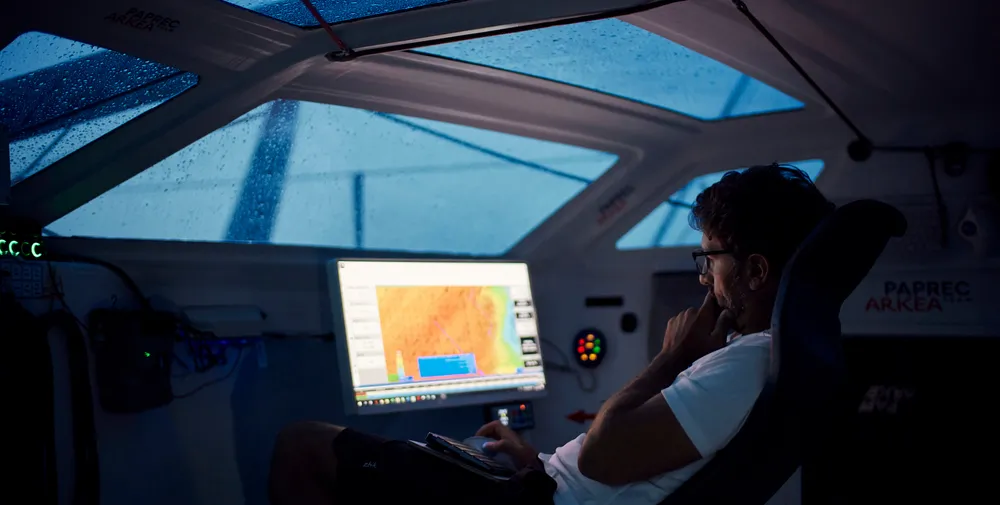
On a Vendée Globe, the sailors download weather files from these different models two or three times a day. They use them to determine the route they need to take, thanks to navigation software, in which the weather data is cross-referenced with the boat's performance data, known as its "polars" (in other words, its identity card). The skippers carry out these route simulations on board their boat, without the help of anyone else. This is known as "routing". They are not allowed to receive any from land or from another boat.
While models are becoming increasingly accurate, one of the most remarkable developments in recent years has been the integration of artificial intelligence (AI) into weather forecasting and routing. AI is at the heart of the drive to improve the quality of forecasts even further.
Skippers involved
Thanks to a partnership between the Vendée Globe and UNESCO, from 2024 skippers will be equipped with automatic weather stations installed on board their boats for the round-the-world race. This collaboration is being developed under the coordination of the Global Ocean Observing System (GOOS), supported by UNESCO through its Intergovernmental Oceanographic Commission (IOC). GOOS is a collaborative system of observations - at sea and by satellite - providing key data for studying the climate, warning of disasters and monitoring the health of marine ecosystems. This global network, implemented by 86 countries, is coordinated by OceanOPS: an operational centre based in Brest (France) jointly supported by UNESCO's IOC and the World Meteorological Organisation (WMO), which aims to centralise and coordinate meteo-oceanographic observation systems.


